Chapter 8
SUSTAINABLE PLANNING FOR POOR COMMUNITIES: URBAN DESIGN STUDIOS AS A CATALYST FOR DEVELOPMENT IN COLOMBIA
This chapter addresses the potential role of sustainable urban design studios as catalysts for development in slum communities of the developing world. Understanding urbanisation processes in the developing world is important to our sustainability challenge because most of the world’s population will live in these places. Moreover, world urbanisation patterns are both a key problem as well as a primary resource. Urban proximity makes sustainability with density possible, however urbanisation is both energy intensive and destructive to natural resources.
Two urban design projects for two fishing villages in the Caribbean coast of Colombia, developed by second year architectural students at the University Tadeo Lozano in Cartagena, Colombia, serve as examples of how student studio projects can help fill the vacuum left by a government’s lack of resources, or unwillingness, to provide slum communities with specific plans to address their planning problems. These include infrastructure, environmental protection, basic services and the aesthetic quality of the urban environment.
The studio also showed how student studio projects may be the vehicle to build consensus on development goals among community members and to raise awareness among governmental officials about the infrastructure and services needs in those communities. The two student projects tested whether marginal communities abandoned by their local governments can envision a brighter future in terms of their social, economic and cultural conditions, to improve their physical infrastructure, and to preserve their surrounding natural environment. The paper concludes that university projects can help fill the governmental void by providing slum communities with local development plans. 176
Introduction
The usefulness of central planning to address infrastructure, economic, environmental and social issues in the developing world has often been debated in developing world literature (Payne, 2002; Richardson, 1977; Van der Linden, 1986). Many ‘successful’ plans for metropolitan regions often bypass the poorest neighbourhoods in those regions benefiting only the elite residential suburbs in those cities. The outcomes of these plans are counter to the U.N. fundamental tenets of sustainable development in the countries of the global South (U.N., 1992a, 1992b). This common neglect frequently accentuates deep economic, social, cultural, and physical divisions in many cities of the developing world (Ward and Gilbert, 1988).
In Latin America, official neglect of slum communities is not new. In fact, it can be considered part of the legacy from Spanish colonisation. In the founding of new cities, Spaniards laid out reticular urban structures placing colonial institutions and the socioeconomic elite at the centre of the new settlement surrounding the Plaza Mayor (or main town square). Beyond that immediate centre of power there lay the districts of merchants, regular residents, and some common facilities such as slaughter houses, tanneries, and warehouses. Further beyond, however, laid a vast ‘periphery’ of indigenous populations and other underclass. Under this urban scheme, the elite at the centre would benefit from its location near the inner sphere of colonial power while the neighbourhoods on the periphery would become permanently under-served (Low, 1993).
Today, although the urban structure of Latin American cities have changed, and this micro version of a centre-periphery model has been replaced, in many cases, by a poly-nucleated model, a ‘periphery’ still exists. It exists, literally, in the string of shanty towns so common in many Latin American cities or, figuratively, in the inner city slums. Many neighbourhoods in that literal or figurative periphery continue to be bypassed by central planning and are left to their own devices in dealing with their problems of infrastructure and services.
Another factor that exacerbates Latin American urban inequalities is the lack of formal planning education in some Latin American countries. In Colombia, for example, planning is generally done by architects who 177‘learned the ropes’ of the profession out of personal interest. Or else, the profession is practiced by planners trained in North America or Europe where the economic and social conditions of their case studies vary widely from the social and economic realities of the country. This lack of planning professionals adequately trained to address the peculiarities of not only Colombia but many Latin American cities is generally reflected in the production of urban plans that do not address the needs of the poorest segments of those societies. In this way, the combination of historical neglect, the unpreparedness of local planning practitioners to deal adequately with a social group they are also supposed to serve and, in many cases, the literal abandonment of these groups by planning officials become more acute in regions with already low human development indicators. Colombia ranked 75 in 2008. The Human Development Index gives an indication of the level of development by a country in the United Nations, taking into consideration life expectancy, literacy, education, and GDP per capita (UNDP, 2008).
Figure 42: Map showing Colombian case study
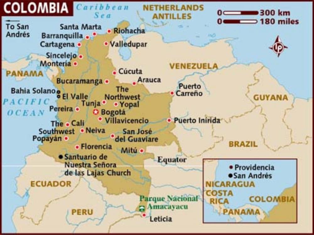
178This is the case of the Caribbean coast of Colombia which holds the lowest HDI in the country (Abello and Giaimo, 2000). Although it is true that residents of slum communities in such territories often devise means to look after themselves through self-help organisations (Perlman, 1976), their efforts are often piecemeal and do not include long-term plans to appropriately address deeper structural problems as would, or should, small-area plans prepared by planning professionals. The complexity of such problems demand nothing less than well-crafted projects designed by planners trained to address the complexity of marginal communities and in close cooperation with the residents of those communities. See location map, Figure 42.
Figure 43: Aerial view of La Boquilla
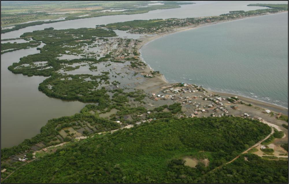
Note: the photographs in this chapter were taken by the Author
Background of the Tadeo Lozano University projects
Mindful of the neglect of slum communities by planning agencies in Colombia and aware of the possibilities of providing quasi-professional urban plans through university-based studios, I set out to approach two slum communities, La Boquilla and Manzanillo, in Cartagena, Colombia 179in my capacity as adjunct faculty in the School of Architecture, Urban Design Program, at the Universidad Tadeo Lozano. Images of the two villages are shown in Figure 43 and Figure 44.
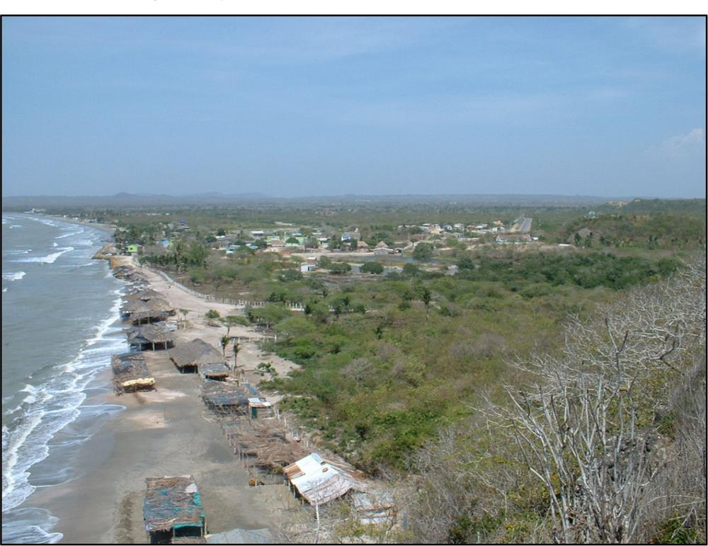
Figure 44: View of Manzanillo del Mar
Although in Cartagena there are many other communities that deserve the same attention, the case of these two was urgent because they are at risk of disappearance under the bulldozers of upscale beach resort and residential development rapidly approaching their area (Figure 45).
The primary goal of this effort was to donate a plan to the leaders and residents of both communities in the belief that the project could be a catalyst to set in motion economic, environmental, social and cultural processes of revitalisation geared to nothing less than saving those communities from extinction. 180
Figure 45: Upscale resort encroaching upon La Boquilla’s beaches

The objective was to produce a basic urban design plan for each community and give the scale-models and drawings to their leaders to be used as master plans so that the community could negotiate with the city’s government a more promissory future.
Their principal problem, as villagers and leaders explained to my group of students, was that, with no development plans of their own, the fate of their communities was subjected to the larger plans of Cartagena’s metropolitan area which did not contain provisions to address their problems, let alone to offer them a promissory future. They argued that the city’s General Plan (locally called Territorial Ordering Plan) did not contain specific elements tailored to address their problems. Furthermore, they were seriously concerned that the General Plan contained elements and policy that would actually lay the legal ground for eradicating their communities to leave room for upcoming beach resorts and upscale high-rise apartment buildings. Local leaders claimed that when they met with local city planning authorities to air their 181concerns, they responded that if the community could provide the planning agency with alternative development options the city would consider revising the part of the General Plan affecting their area. The local city planners argued that they did not have enough resources to revise the General Plan and to produce area-plans for their communities. But given that neither of these communities have resources or the technical knowledge to produce any kind of alternative plans, they felt their destiny was sealed and fateful. Against such a gloomy backdrop, the University’s offer to prepare an alternative plan for their communities was most welcomed.
Background: La Boquilla and Manzanillo
La Boquilla is a very poor fishing village of 15,000 people of African descent. The older residents track their origins back to the 18th century when runaway slaves from Spanish colonial Cartagena formed refugee camps (called ‘palenques’) in the swampy lands and mangrove lagoons far away from the Spanish settlement. The economic base of both communities used to be traditional fishing and small scale agriculture. This economy was operational for over two centuries but, due to development pressures coming from nearby Cartagena, today it is dwindling and its nature is changing. Their rich fishing and handicraft traditions are being replaced quickly by the catering to local and foreign visitors who visit the beautiful community’s beaches.
Another reason for this switching to a different trade as a new means of sustenance is the gradual deterioration of the formerly rich wetland ecosystem surrounding the community. The ever-growing urban perimeter of Cartagena is encroaching upon the mangrove lagoon, degrading and contaminating the body of water and annihilating the fishery in the system. Today, the lagoon and mangrove forest that the community had exploited so successfully and sustainably for generations have entered a steady process of decay. In addition, the construction of a major interstate highway and the land filling of wetlands to lay firm grounds for the construction of international resorts and high-end apartment buildings blocked waterways between the lagoon and the Caribbean Sea, thus further degrading the ecosystem. As a result, the community’s fishery has been drastically reduced. 182
As for public services, both La Boquilla and Manzanillo have limited electricity, no potable water, and no sewage infrastructure. Electric supply is shut off up to twelve hours a day, sometimes four days a week, which causes spoiling of food and the warming of cold drinks the community sells to tourists as another form of livelihood. In addition, given that the natural conditions in both communities are those typical of tropical coastal regions with average daily temperatures of 30º centigrade and relative humidity of 80–90%, residents complain that during power blackouts night-time is sometimes unbearable with no electricity to power fans and with mosquitoes swarming the village.
Paradoxically, the prime location of both communities has made their future uncertain. La Boquilla is only five minutes from Cartagena International Airport and has three kilometres of white sandy beaches facing the Caribbean Sea. There is the beautiful Cienaga de la Virgen lagoon and mangrove swamps lie opposite the Bay of Cartagena. A very important interstate highway (between Cartagena and Barranquilla) also runs in the vicinity of the community. These location advantages, however, have made La Boquilla prime land for upscale development. The ongoing construction of resorts and high-end apartment buildings threatens the future existence of the community. To make matters worse, those types of developments are well within the General Plan’s projections for the area classified as ‘lands for urban expansion’.
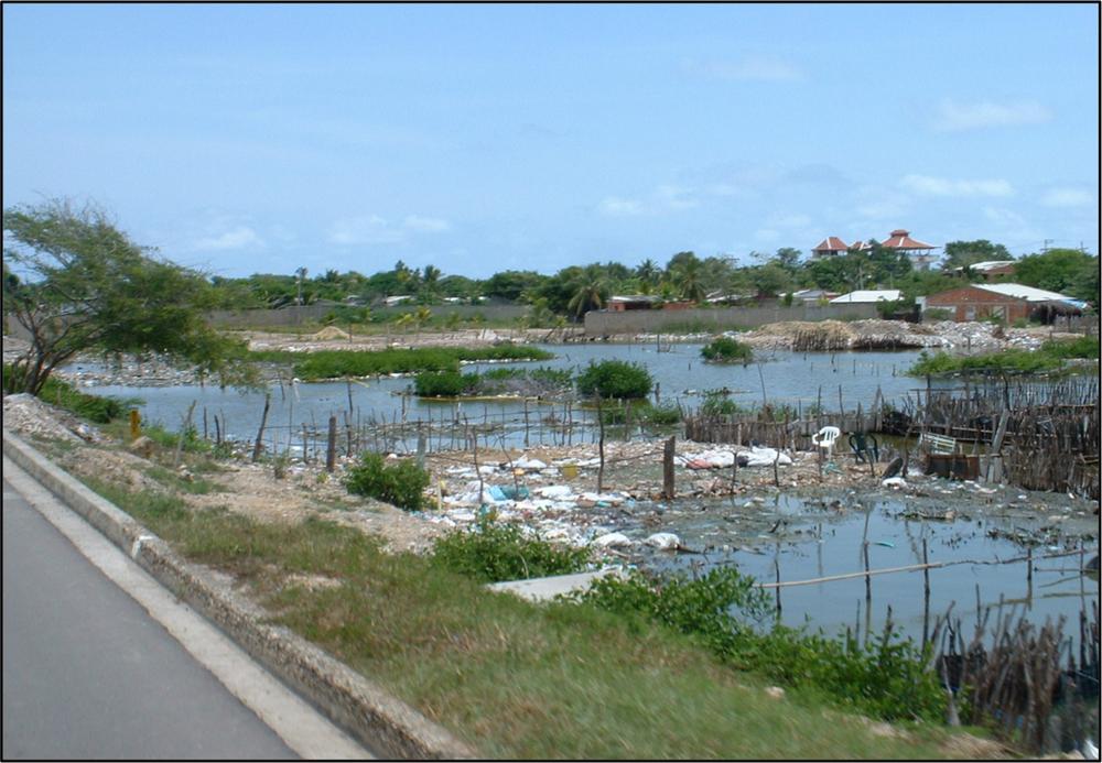
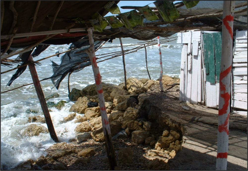
To counteract this situation is difficult. Given the poor economic conditions of La Boquilla, developers have it easy to buy residents out, offering well-below market values to local farmers. Furthermore, given that many of the La Boquilla residents actually squat on lands marked as flood-prone (for being too close to the mangrove lagoon), some of the residents are all too eager to sell their properties for whatever money they are offered before governments officials initiate processes of eviction. In the case of the residents with land titles, the opportunity to sell land that was formerly a squatter settlement is taken as a life-time opportunity to improve their lives by selling and moving out to another urban location. The combination of fast moving resort and residential development on the fringes of the community and the environmental degradation of the mangrove lagoon have induced a gradual process of social, cultural and economic deterioration forecasting a future for the community that is rather hopeless and bleak (see Figure 46). 183
Figure 46: Environmental degradation on flood-prone areas
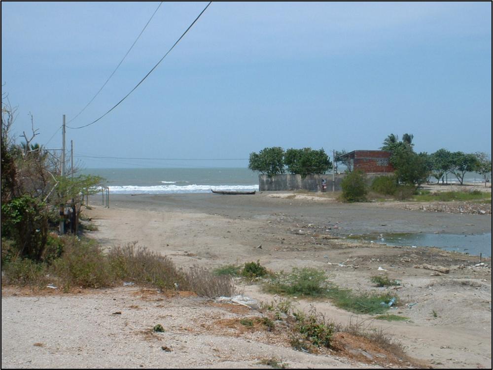
Manzanillo (population 1200) is just five kilometres from La Boquilla but faces similar problems. The area is equally classified in Cartagena’s General Plan as Land for Urban Expansion. Residents’ livelihood out of traditional fishing and handicraft production is also shifting to catering the insipient tourism attracted to their beaches. The fishing industry has also deteriorated due to the degraded mangrove fishery and the inability to fish in deeper waters for lack of appropriate vessels. Basic infrastructure is also deficient in Manzanillo. The community has electricity but no sewage or potable water. Its seaside is vulnerable to sea storms that occasionally wash off the road on the seaside edge of the community (see Figure 47).
Just like in La Boquilla, the residents of Manzanillo feel helpless to secure the future of their village. Leaders and residents are afraid the approaching high-end developments will eventually force them out and thus lose their community. In meetings with the university students, the residents expressed the same fears that surfaced in the meetings with the 184residents of La Boquilla: they feel powerless to convince Cartagena’s central government of their right to stay there. They are also eager to convince the government that Manzanillo could become a tourist asset if they were given the resources to restructure their cottage fishing industry, their handicraft production, their cultural traditions, and improve the physical appearance of their village. They feel their town and way of life are part of Colombia’s cultural heritage with potential for becoming tourist attractions for national and foreign visitors.
Figure 47: Sea surges ravage edge of town for lack of a breakwater
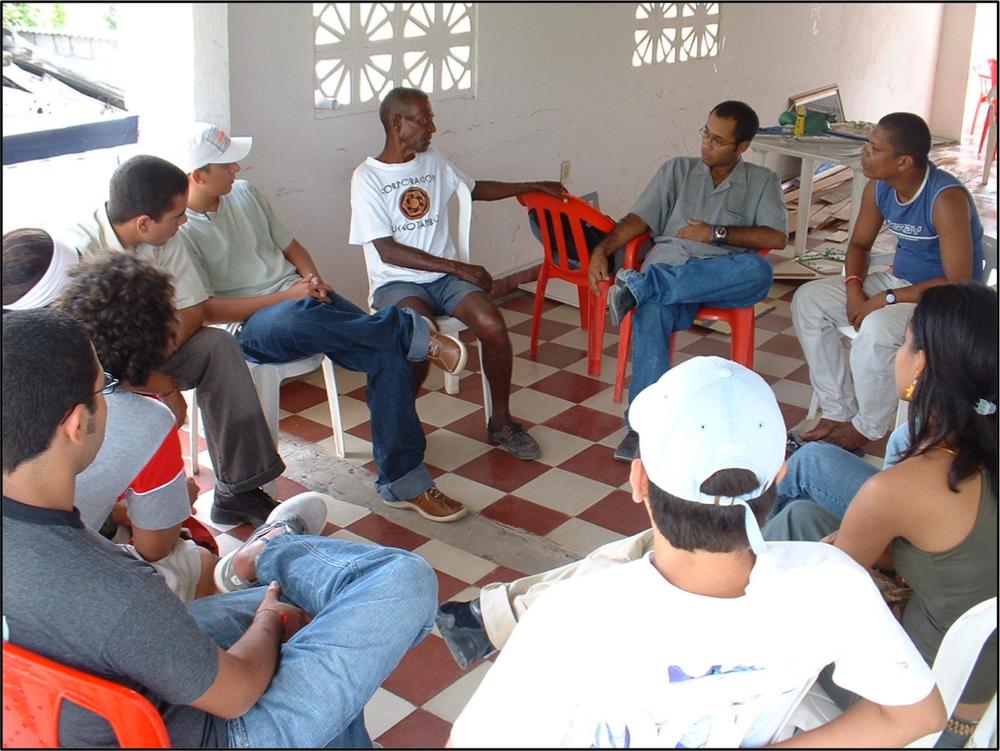
The community meetings with both villages (see Figure 48) underscored their drive to bypass central authorities to find solutions to their problems on their own. The issues identified by the community leaders and residents in those meetings yielded a long list of unmet wants and desires long neglected by planning authorities and local politicians. What was most remarkable about those meetings, however, was the residents’ display of creativity to articulate solutions to their problems, indeed not too different from what urban planning professionals would prescribe in a similar situation. 185
Figure 48: Meeting with residents and local leaders
Urban design plans
In both communities, the list of issues and their potential solutions ranged from the very policy-oriented, such as declaring their communities sites of Afro-Colombian Cultural Heritage to preserve traditional handicraft and fishing techniques, to the very physical such as the building of jetties to preserve the beach area or the dredging of a natural channel that connects the lagoon to the sea to allow the free flow of water between both systems.
In the final product, the plans for both communities included the standard elements of a comprehensive urban design plan including land use, housing, circulation, infrastructure, and services, but focused on specific elements that addressed their particular problems.
The environmental design for both La Boquilla and Manzanillo, for example, included the recuperation of the mangrove swamp and lagoon by dredging the clogged watercourse connecting lagoon and sea. 186Blocking the waterway causes flooding in parts of the community during the rainy season. By opening the watercourse permanently and allowing stormwaters to move freely out to sea, they would maintain stable water levels inside the lagoon all year and stop the flooding.
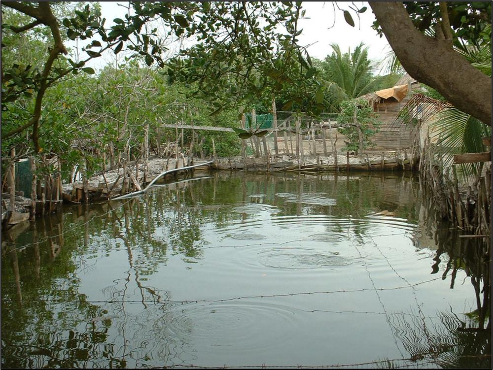
Figure 49: Sand-clogged connection, Manzanillo del Mar
In the dry season, the free movement of sea water back into the lagoon would maintain a deeper level of water and allow fishermen to dig out pools for fish-farming inside the mangrove swamp. The farmed fish could then be sold to neighbouring communities. This solution proposed by residents of both communities demonstrates that local residents have sophisticated knowledge of the hydraulics of wetlands ecosystems and the benefits of better agricultural production to their economy. 187
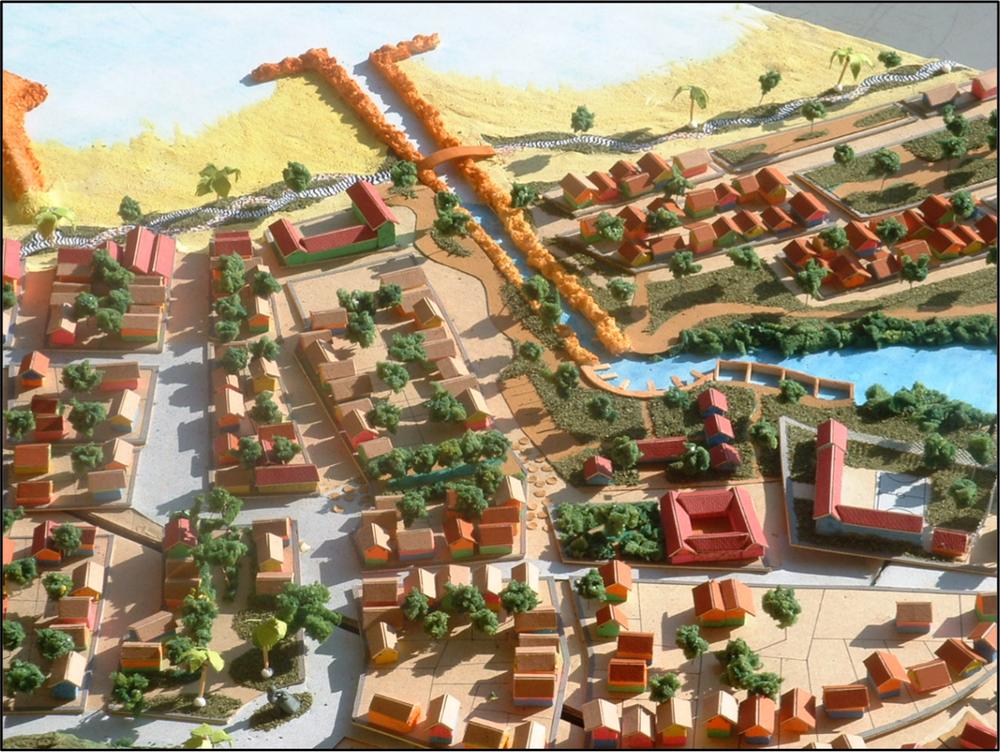
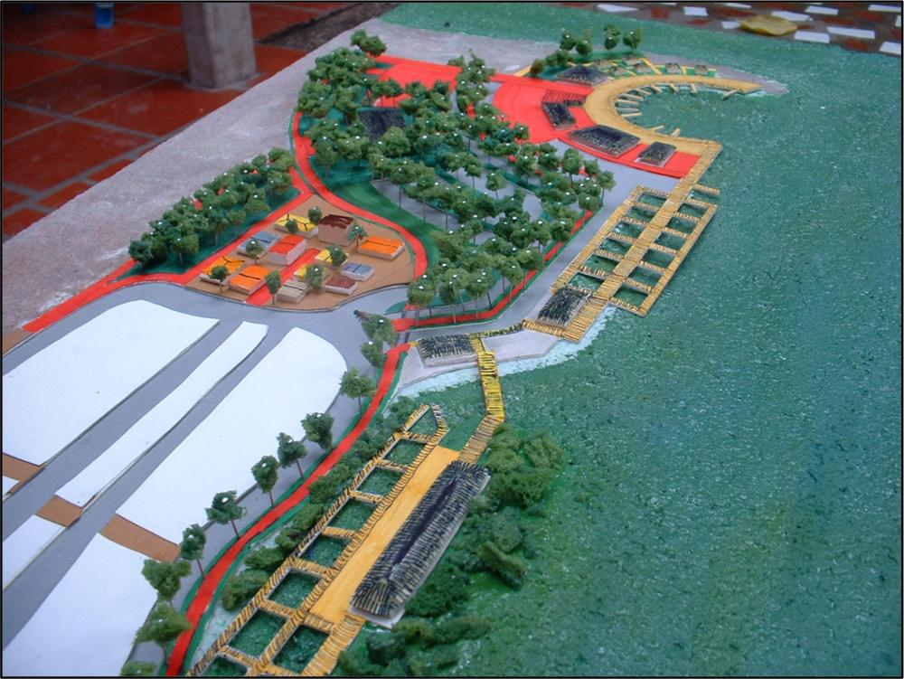
Figure 50: Model of Manzanillo del Mar showing dredged canal
An environmental strategy was part of the economic strategy. The residents were aware that with the reopening of the water flow between both natural systems, the lagoon fishery would recuperate and the fishing industry revive. Along with this strategy, residents suggested the construction of a long needed fishing cooperative with a shipyard to build fishing boats more adequate to venture on deeper sea waters.
Presently, they can only fish in the proximity of the beach due to the vulnerability of their canoes to sail further out. By the same token, harvesting fish from the lagoon is currently done in a very rudimentary fashion resulting in poor quality and quantities of the fish harvested and in further environmental degradation of the mangrove lagoon ecosystem (see Figure 51). 188
Figure 51: Lack of appropriate fishing ponds limits fish harvest
To this end, the project featured a band of properly designed and constructed aquiculture ponds to address both problems. To take advantage of the tourist potential of both communities, the economic element of the plan included development of a cultural-tourist program where national and foreign visitors, lodged in cabins near the fishing coop, would pay for week-long workshops to learn traditional fishing, fish-net weaving, manufacture of local handicrafts, and folk dances.
Figure 52 shows properly designed and constructed aquiculture ponds to increase productivity and quality of fish harvested. At the far end of this image, there is the fishing coop and eco-tourism centre with boarding cabins to house participants in traditional fishing and crafts workshops. 189
Figure 52: Design proposal for aquiculture ponds
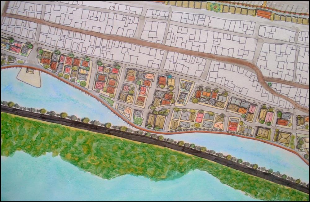
The housing element of the plan included a relocation project for a large group of community residents currently living in shacks on the border of the lagoon. Those residents would gradually move to new stilt-housing in the same location so that social networks would not be disrupted and planning officials would not have an issue with seasonal flooding of the area. Figure 53 shows the proposed residential rehabilitation and construction of new housing following existing traditional settlement pattern in the region.
The circulation element of both plans included not just the pavement of some dirt roads in the community but the rather innovative system of stone-paving the strip of roadway in front of the houses, in lieu of conventional sidewalks. This way, given that car ownership in the community is low, the roadway itself might be used as public space for social gatherings and as playground for children. Although they acknowledged this solution contradicts conventional prescriptions about street design, they argued they wanted to keep the old social practice of 190gathering and playing in the streets, actually very common in many poor communities of the developing world. An added advantage to this solution, community designers claimed, is the considerable savings in the construction of other more conventional recreational spaces such as parks. Although the issue of parks was debated in those meetings, some residents’ argument that ‘the beach is our park’ settled the issue.
Figure 53: Construction of new housing
The cultural component of the plan took the form of a cultural complex with spaces to teach their youngsters and visitors traditional music and dancing. This suggestion came out of their concern for the dwindling interest in the part of their youth to practice those cultural expressions. They claimed that the lack of support and facilities for those activities was swaying teenagers and kids towards imported forms of rap music. They worried that if the trend continued, their traditional culture would eventually be forgotten.
Regional development was a strategy also considered by both communities and captured in the projects. They proposed to establish a network of seaside villages along the coast of Cartagena. The proposal 191was to start by connecting La Boquilla with Manzanillo through the natural network of water channels crisscrossing the mangrove swamp. The lagoon banks would also be landscaped and designated as a scenic route connecting to hiking trails in the nearby woods. The path would end in a coloured-paved boardwalk along the beach in the community of Manzanillo. They thought the aquatic ways, the hiking trails, and the beach boardwalk could be pitched to Cartagena’s City Council as a tourist amenity for the entire region.
Student project outcomes
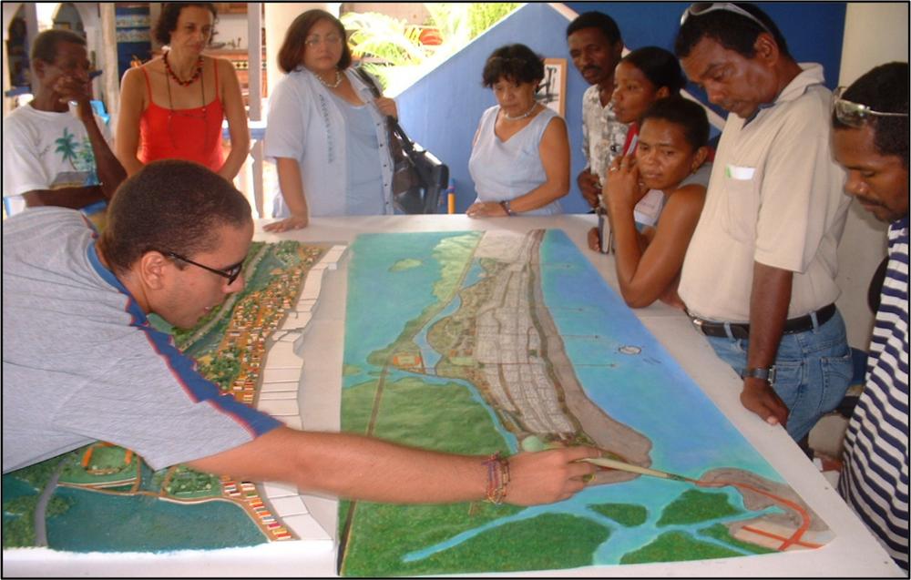
At the end of the semesters, students produced elaborate models and plans that were handed in to community leaders and residents. Delivering the projects to the villages turned out to be larger events than expected (see Figure 54). For the residents of both communities, it was the first time that their ideas had been listened to and their own solutions to their problems materialised in scaled-models and drawings. As expressed by one community leader, ‘it is as if there is actually a government in the city and they were listening to us’. The students presented the projects to the community in public meetings held in one the resident’s homes in each village. The high point of these presentations was the sight of a large crowd of community residents gathering around models and plans pointing with their fingers at their tiny scaled houses, chatting enthusiastically about the impact the proposed trails, streets, scenic routes, restored ecosystem, and other elements of the project would have on their particular properties.
Following these public presentations, word got out to the local media that the Tadeo Lozano University was crafting plans for La Boquilla and Manzanillo. A few weeks later, Cartagena’s main newspaper, El Universal (2004), published a full page article featuring both projects. Following that publication, government officials and two non-government organisations (NGOs) doing work for the development of slum communities in Cartagena contacted the community leaders and the Faculty of Architecture to inquire about the projects. The public planners suggested the projects be lodged in the city’s Planning Department to be considered in future plans about the area. And, one NGO requested the models to be permanently displayed in their facilities as examples of slum redevelopment. 192
Figure 54: Students presenting the project to community leaders
The lesson for La Boquilla and Manzanillo from the year-long process and for the local planning agency and NGOs is that planning matters. The attention raised by the two projects among government planners showed community leaders and residents the importance of materialising into scaled-models and drawings community-based ideas to address their own problems.
To date, however, a revision of the General Plan for the city has not been called for by the City Council, so it is uncertain whether government officials will eventually give those student projects the attention they deserve to actually include in the City’s plans for the area. Unfortunately, it seems the label ‘student project’ is a handicap that prevents government officials from taken the projects seriously. For La Boquilla and Manzanillo, then, the next challenge is to find resources to turn ‘student’ into ‘professional’ projects to have more leverage before politicians and planning authorities. 193
Conclusions
Cartagena Planning Department’s response to these two modest student projects highlights the potential role university-led sustainable urban design projects can play in the improvement of slum communities in the developing world. The materialisation of actual models, drawings, and policy documents reflecting solutions to the problems of under-served social groups can make the difference between wishful thinking on the part of slum dwellers, unmet promises on the part of public officials, and real hope for improving the living conditions of those groups.
The overriding lesson from this experience was that government-abandoned communities armed with urban design and planning documents can potentially change their usual fateful destiny. If countries of the southern hemisphere are to heed the United Nations Development Program’s recommendations towards sustainable development (UN NSDS, 2002), they must attend to the development potential of their poorest and most under-represented communities. However, given the lack of financial and human resources in the part of local governments to produce sustainable development plans for their slum communities, the resources available in public and private universities must be put to service to make up for such deficiency.
194
References
Abello, A. and Giaimo, S. (2000) Compiladores, poblamiento y ciudades del caribe Colombiano. Barranquilla, Colombia: Fonade y Universidad del Atlantico.
El Universal Newspaper (2004) La boquilla y manzanillo tienen sueños para 2011. Cartagena de Indias, Colombia, June 7th 2004.
Low, S. (1993) ‘Cultural meaning of the plaza,’ in R. Rotenbergand G. M. McDonogh (eds.), The cultural meaning of urban space. Amherst: Bergin and Garvey, pp. 75–94.
Payne, G. (ed.) (2002) Land, rights and innovation: improving tenure security for the urban poor. London: ITDG.
Perlman, J. (1976) The myth of marginality: urban poverty and politics in Rio de Janeiro. Berkeley: University of California Press.
Richardson, H. (1977) City size and national spatial strategies in developing countries. Washington DC: World Bank.
UNDP (2008) Human development index. Available at: http://hdr.undp.org/en (consulted 1st May 2008).
U.N. (1992a) MDG Millennium Development Goals. Conference on environment and development. Rio de Janeiro, Brazil. Available at www.undp.org/mdg (consulted 1st May 2008)
U.N. (1992b) Agenda 21 Conference on environment and development. Rio de Janeiro, Brazil. Available at www.un.org (consulted 1st May 2008).
U.N. (2002) NSDS. United Nations national sustainable development strategies. Conference on Environment and Development. Rio de Janeiro, Brazil. Available at www.un.org (consulted 1st May 2008).
Van der Linden, J. (1986) The sites and services approach reviewed: solution or stopgap to the Third World housing shortage? Aldershot: Gower.
Ward, P. and Gilbert, A. (1988) ‘Land for the rich, land for the poor,’ in J. Gugler (ed.), Urbanization of the Third World. Oxford: Oxford University Press.